Lot Details
Lot 280
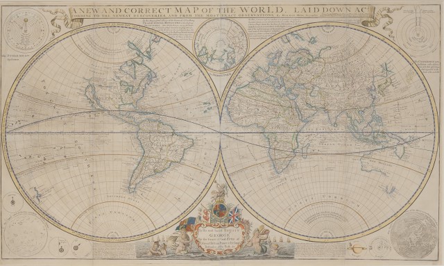
MOLL, HERMAN A New and Correct Map of the World, Laid Down According to the Newest Discoveries, and From the Most Exact Observations. London: I and T. Bowles, P. Overton, and John King [undated, but likely circa 1736
]. Two conjoined sheets. 22 x 38 inches (59.5 x 96.5 cm) between neatlines, titled at the head in a cartouche ; attractive, probably later color. A tiny crease at lower left. Framed, not examined out of frame.
This map of the two hemispheres also bears inset diagrams of the Ptolemean and Copernican systems, the sun and the moon, tables of the individual planets and their satellites and the North Pole. California is depicted as an island, and Australia and New Zealand are partially mapped. The Library of Congress dates this issue 1736, with a question mark, though elsewhere we note dates as early as circa 1720.
C Property of a Florida Lady
Additional Notes & Condition Report
No condition report? Click here to request one.