Sale 22JK02 | Catalogue
181 - 240 of 326
![Lot image - [MANUSCRIPT-LIQUOR and DISTILLING] [ANONYMOUS]. El Estilador Licoristal.](/sites/default/files/images/lots/897/1557897.jpg)
Lot 181
[MANUSCRIPT-LIQUOR and DISTILLING] [ANONYMOUS]. El Estilador Licoristal.
Estimate: $700 - $1,000
Sold for $7,560
(includes buyer's premium)
![Lot image - [MAP-AMERICA] OGILBY/MONTANUS. Insulae Americanae in Oceano Septentrionali cum terris adiacentibus.](/sites/default/files/images/lots/481/1561481.jpg)
Lot 182
[MAP-AMERICA] OGILBY/MONTANUS. Insulae Americanae in Oceano Septentrionali cum terris adiacentibus. [London: John Ogilby, I...
Estimate: $200 - $300
Sold for $409
(includes buyer's premium)
![Lot image - [MAP-AMERICA] VAUGONDY, ROBERT DE. Amerique Septentrionale, Dressee, sur les Relations les Plus Modernes des Voyageurs et Navigateurs, et Divisee Suivant les Differentes Possessions des Europeens.](/sites/default/files/images/lots/702/1573702.jpg)
Lot 183
[MAP-AMERICA] VAUGONDY, ROBERT DE. Amerique Septentrionale, Dressee, sur les Relations les Plus Modernes des Voyageurs et Navig...
Estimate: $300 - $500
Sold for $189
(includes buyer's premium)
![Lot image - [MAP] BELLIN, JACQUES NICOLAS. Carte Reduite des Costes de la Louisiane et de la Floride.](/sites/default/files/images/lots/678/1573678.jpg)
Lot 184
[MAP] BELLIN, JACQUES NICOLAS. Carte Reduite des Costes de la Louisiane et de la Floride. Paris: S. Bellin, [circa 176...
Estimate: $400 - $600
Sold for $1,197
(includes buyer's premium)
![Lot image - [MAPS-BELGIUM] Group of six maps.](/sites/default/files/images/lots/293/1575293.jpg)
Lot 185
[MAPS-BELGIUM] Group of six maps. Comprising: FAVOLIUS, [HUGO] AND ABRAHAM ORTELIUS. Belgii Veteris Typus ex Conatibus Ge...
Estimate: $200 - $300
Sold for $126
(includes buyer's premium)
![Lot image - [MAPS-CALIFORNIA as an ISLAND] Two examples of this cartographic misconception.](/sites/default/files/images/lots/985/1583985.jpg)
Lot 186
[MAPS-CALIFORNIA as an ISLAND] Two examples of this cartographic misconception. Comprising: SANSON DABBEVILLE, NICHOLAS....
Estimate: $400 - $600
Sold for $441
(includes buyer's premium)
![Lot image - [MAP-CENTRAL AMERICA] BONNE, [RIGOBERT]. Carte du Mexique ou de la Nlle. Espagne Contenant Aussi le Nouveau Mexique, la Californie, avec une Partie des Pays Adjacents...](/sites/default/files/images/lots/110/1571110.jpg)
Lot 187
[MAP-CENTRAL AMERICA] BONNE, [RIGOBERT]. Carte du Mexique ou de la Nlle. Espagne Contenant Aussi le Nouveau Mexique, la Califor...
Estimate: $400 - $600
Sold for $252
(includes buyer's premium)
![Lot image - [MAPS-CUBA] BELLIN, JACQUES NICOLAS. Carte Hydrographique de la Baye de la Havane](/sites/default/files/images/lots/710/1573710.jpg)
Lot 188
[MAPS-CUBA] BELLIN, JACQUES NICOLAS. Carte Hydrographique de la Baye de la Havane. Paris: S. Bellin, dated 1762. Engraved ma...
Estimate: $400 - $600
Sold for $535
(includes buyer's premium)
![Lot image - [MAPS-CUBA] BELLIN, JACQUES NICOLAS. Carte Reduite de lIsle de Cube Dressee au Depot des Cartes et Plans de la Marine.](/sites/default/files/images/lots/709/1573709.jpg)
Lot 189
[MAPS-CUBA] BELLIN, JACQUES NICOLAS. Carte Reduite de lIsle de Cube Dressee au Depot des Cartes et Plans de la Marine. Pari...
Estimate: $600 - $800
Sold for $378
(includes buyer's premium)
![Lot image - [MAPS-CUBA] JEFFERYS, THOMAS. The Island of Cuba with part of the Bahama Banks & the Martyrs.](/sites/default/files/images/lots/983/1557983.jpg)
Lot 190
[MAPS-CUBA] JEFFERYS, THOMAS. The Island of Cuba with part of the Bahama Banks & the Martyrs. London: Thomas Jefferys, 20 Fe...
Estimate: $600 - $800
Sold for $378
(includes buyer's premium)
![Lot image - [MAP-HAVANA] [DEL RIO, JOSE]. Plan of the Harbour and City of the Havana, surveyed by Don Joseph de Rio, Captain in the Spanish Navy.](/sites/default/files/images/lots/708/1573708.jpg)
Lot 191
[MAP-HAVANA] [DEL RIO, JOSE]. Plan of the Harbour and City of the Havana, surveyed by Don Joseph de Rio, Captain in the Spanish...
Estimate: $800 - $1,200
Sold for $819
(includes buyer's premium)
![Lot image - [MAP-CUBA] DE O[]REILLY, CALLE. Plano Topografico y Pintoresco de la Habana.](/sites/default/files/images/lots/829/1557829.jpg)
Lot 192
[MAP-CUBA] DE O[]REILLY, CALLE. Plano Topografico y Pintoresco de la Habana. Paris: Calle de O Reilly, 1847. Lithographed map, with...
Estimate: $400 - $600
Sold for $693
(includes buyer's premium)
![Lot image - [MAPS-CUBA] Two maps of Cuba by Thomas Jefferys.](/sites/default/files/images/lots/850/1557850.jpg)
Lot 193
[MAPS-CUBA] Two maps of Cuba by Thomas Jefferys. Comprising: JEFFERYS, T[HOMAS]. Plan of the City and Harbor of Havana [...
Estimate: $150 - $250
Sold for $157
(includes buyer's premium)
![Lot image - [MAPS/VIEWS-CUBA] Six antique maps and views of Havana.](/sites/default/files/images/lots/219/1571219.jpg)
Lot 194
[MAPS/VIEWS-CUBA] Six antique maps and views of Havana. Comprising PAZZI, GIUSEP[PE]. Piano della Citta e Porto dellHava...
Estimate: $300 - $500
Sold for $882
(includes buyer's premium)
![Lot image - [MAPS-CUBA & HAITI] [VANDERMAELEN, PHILLIPE MARIE GUILLAIME]. Ile de Cuba [And:] Haiti ou St. Domingue.](/sites/default/files/images/lots/722/1574722.jpg)
Lot 195
[MAPS-CUBA & HAITI] [VANDERMAELEN, PHILLIPE MARIE GUILLAIME]. Ile de Cuba [And:] Haiti ou St. Domingue. [Brussels: Phillipe...
Estimate: $200 - $300
Sold for $157
(includes buyer's premium)
![Lot image - [MAPS-EUROPE] Group of six map of England & Europe.](/sites/default/files/images/lots/240/1575240.jpg)
Lot 196
[MAPS-EUROPE] Group of six map of England & Europe. Comprising: SANSON, N[ICOLAS]. Britannicae Insulae, in quibus Albium...
Estimate: $300 - $500
Sold for $189
(includes buyer's premium)
![Lot image - [MAPS-FACSIMILES] Mapas Espanoles de America, Siglos XV-XVII.](/sites/default/files/images/lots/598/1557598.jpg)
Lot 197
[MAPS-FACSIMILES] Mapas Espanoles de America, Siglos XV-XVII. Madrid: 1951. First edition, an unnumbered copy from the editi...
Estimate: $100 - $200
Sold for $819
(includes buyer's premium)
![Lot image - [MAPS] FADEN, WILLIAM and OTHERS. A disbound atlas of maps and sea charts.](/sites/default/files/images/lots/359/1571359.jpg)
Lot 198
[MAPS] FADEN, WILLIAM and OTHERS. A disbound atlas of maps and sea charts. Circa late 18th century. A group of about 2...
Estimate: $400 - $600
Sold for $2,394
(includes buyer's premium)
![Lot image - [MAP-FLORIDA] SARTINE, ANTOINE DE. Carte Reduite des Cotes et de lInterieur de la Presquile de la Floride, avec le Detroit de Cette Presquile et le Canal de Bahama](/sites/default/files/images/lots/971/1570971.jpg)
Lot 199
[MAP-FLORIDA] SARTINE, ANTOINE DE. Carte Reduite des Cotes et de lInterieur de la Presquile de la Floride, avec le Detroit de...
Estimate: $1,000 - $1,500
Sold for $1,512
(includes buyer's premium)
![Lot image - [MAP-FLORIDA] COLTON, C. B. & G. W. Florida.](/sites/default/files/images/lots/849/1557849.jpg)
Lot 200
[MAP-FLORIDA] COLTON, C. B. & G. W. Florida. New York: G. W. & C. B. Colton & Co., 1868. Lithographed map. 17 1/4 x 26 1/2...
Estimate: $100 - $200
Sold for $315
(includes buyer's premium)
![Lot image - [MAPS-FLORIDA] Group of five antique maps and views of Pensacola and St. Augustine.](/sites/default/files/images/lots/835/1557835.jpg)
Lot 201
[MAPS-FLORIDA] Group of five antique maps and views of Pensacola and St. Augustine. Comprising: JEFFERYS, T[HOMAS] [and]...
Estimate: $300 - $500
Sold for $504
(includes buyer's premium)
![Lot image - [MAP-FLORIDA] BRADLEY, WILLIAM M. AND BROTHERS. Florida [on sheet with]: West Indies and Central America.](/sites/default/files/images/lots/120/1571120.jpg)
Lot 202
[MAP-FLORIDA] BRADLEY, WILLIAM M. AND BROTHERS. Florida [on sheet with]: West Indies and Central America. [Philadelphia]: Wm...
Estimate: $100 - $200
Sold for $63
(includes buyer's premium)
![Lot image - [MAPS-FLORIDA] Group of five 19th century maps of Florida.](/sites/default/files/images/lots/838/1557838.jpg)
Lot 203
[MAPS-FLORIDA] Group of five 19th century maps of Florida. Comprising: MITCHELL Jr., S. AUGUSTUS. County Map of Florida [...
Estimate: $400 - $600
Sold for $252
(includes buyer's premium)
![Lot image - [MAPS-FLORIDA] Three small format English maps of Florida.](/sites/default/files/images/lots/112/1571112.jpg)
Lot 204
[MAPS-FLORIDA] Three small format English maps of Florida. Comprising: A New and Accurate Map of East and West Florida, D...
Estimate: $400 - $600
Sold for $598
(includes buyer's premium)
![Lot image - [MAPS-FLORIDA & WEST INDIES] Two maps from Carey & Leas A Complete Historical, Chronological, and Geographical American Atlas.](/sites/default/files/images/lots/152/1571152.jpg)
Lot 205
[MAPS-FLORIDA & WEST INDIES] Two maps from Carey & Leas A Complete Historical, Chronological, and Geographical American Atlas....
Estimate: $300 - $500
Sold for $220
(includes buyer's premium)
![Lot image - [MAP-GULF] BELLIN, JACQUES NICOLAS. Carte Reduite du Golphe du Mexique et des Isles de lAmerique pour Servir aux Vaisseaux du Roy.](/sites/default/files/images/lots/839/1557839.jpg)
Lot 206
[MAP-GULF] BELLIN, JACQUES NICOLAS. Carte Reduite du Golphe du Mexique et des Isles de lAmerique pour Servir aux Vaisseaux du...
Estimate: $200 - $300
Sold for $346
(includes buyer's premium)
![Lot image - [MAPS-GULF] Group of five decorative antique maps of the gulf region, most hand-colored.](/sites/default/files/images/lots/840/1557840.jpg)
Lot 207
[MAPS-GULF] Group of five decorative antique maps of the gulf region, most hand-colored. Comprising: [BELLIN, JACQUES NIC...
Estimate: $300 - $500
Sold for $535
(includes buyer's premium)
![Lot image - [MAP] HOMANN, JOHANN BAPTIST. Regni Mexicani seu Novae Hispaniae Ludovicianae, N. Angliae, Carolinae, Virginiae et Pensylvaniae nec non Insularum Archipelagi Mexicani in America Septentrionali Accurata Tabula.](/sites/default/files/images/lots/855/1557855.jpg)
Lot 208
[MAP] HOMANN, JOHANN BAPTIST. Regni Mexicani seu Novae Hispaniae Ludovicianae, N. Angliae, Carolinae, Virginiae et Pensylvaniae...
Estimate: $800 - $1,200
Sold for $598
(includes buyer's premium)
![Lot image - [MAP] HOMANN, JOHANN BAPTIST. Dominia Anglorum in Praecipuis Insulis Americae ut funt Insula S. Christophori Antegoa Iamaica Barbados nec non insulae Bermudes vel Sommers dictae, singulari mappa omnia exlubita et edita ab Homannianis.](/sites/default/files/images/lots/832/1557832.jpg)
Lot 209
[MAP] HOMANN, JOHANN BAPTIST. Dominia Anglorum in Praecipuis Insulis Americae ut funt Insula S. Christophori Antegoa Iamaica Ba...
Estimate: $200 - $300
Sold for $126
(includes buyer's premium)
![Lot image - [MAP-JAMAICA] SCHENK, PET[ER] JR. AND VISS[CH]ER, NICOLA[ES II]. Jamaica, Americae Septentrionalis Ampla Insula, a Christophoro Columbo Detecta, in suas Gubernationes Peraccurate Distincta.](/sites/default/files/images/lots/715/1574715.jpg)
Lot 210
[MAP-JAMAICA] SCHENK, PET[ER] JR. AND VISS[CH]ER, NICOLA[ES II]. Jamaica, Americae Septentrionalis Ampla Insula, a Christophoro...
Estimate: $300 - $500
Sold for $598
(includes buyer's premium)
![Lot image - [MAP] JANSSON, JAN. Insulae Americanae in Oceano Septentrionali cum Terris adiacentibus.](/sites/default/files/images/lots/830/1557830.jpg)
Lot 211
[MAP] JANSSON, JAN. Insulae Americanae in Oceano Septentrionali cum Terris adiacentibus. Amsterdam: Apud Joannem Jansonium,...
Estimate: $800 - $1,200
Sold for $535
(includes buyer's premium)
![Lot image - [MAP-MARTINIQUE] DELISLE, GUILLAUME. Carte de lIsle de la Martinique Colonie Francoise de lune des Isles Antilles de lAmerique.](/sites/default/files/images/lots/831/1557831.jpg)
Lot 212
[MAP-MARTINIQUE] DELISLE, GUILLAUME. Carte de lIsle de la Martinique Colonie Francoise de lune des Isles Antilles de lAmeriq...
Estimate: $300 - $500
Sold for $126
(includes buyer's premium)
![Lot image - [MAPS] Group of four hand-colored antique maps.](/sites/default/files/images/lots/843/1557843.jpg)
Lot 213
[MAPS] Group of four hand-colored antique maps. Comprising: [HONDIUS/MERCATOR]. Cuba Insula [on sheet with:] Hispaniola I...
Estimate: $200 - $300
Sold for $756
(includes buyer's premium)
![Lot image - [MAPS] Group of approximately twenty-three miscellaneous maps of Europe, America and the West Indies, and others.](/sites/default/files/images/lots/232/1575232.jpg)
Lot 214
[MAPS] Group of approximately twenty-three miscellaneous maps of Europe, America and the West Indies, and others. Comprising...
Estimate: $300 - $500
Sold for $283
(includes buyer's premium)
![Lot image - [MAP-MEXICO] [JANSSON, JAN]. Nova Hispania et Nova Galicia.](/sites/default/files/images/lots/958/1557958.jpg)
Lot 215
[MAP-MEXICO] [JANSSON, JAN]. Nova Hispania et Nova Galicia. [Amsterdam: circa 1640 or later]. Engraved map with hand-c...
Estimate: $200 - $300
Unsold
![Lot image - [MAP] ORTELIUS, ABRAHAM. La Florida [on sheet with:] Pervviae Avriferae Regionis Typvs [and:] Gvastecan.](/sites/default/files/images/lots/577/1557577.jpg)
Lot 216
[MAP] ORTELIUS, ABRAHAM. La Florida [on sheet with:] Pervviae Avriferae Regionis Typvs [and:] Gvastecan. Antwerp: circaD...
Estimate: $700 - $1,000
Sold for $441
(includes buyer's premium)
![Lot image - [MAPS-PERSIA & ASIA MINOR] Group of nine maps.](/sites/default/files/images/lots/693/1574693.jpg)
Lot 217
[MAPS-PERSIA & ASIA MINOR] Group of nine maps. Comprising: Two copies of DANVILLE, [JEAN-BAPTISTE BOURGUIGNON]. Carte...
Estimate: $300 - $500
Sold for $189
(includes buyer's premium)
![Lot image - [MAPS-POLAR EXPEDITION MAPS] Group of seven and one photograph.](/sites/default/files/images/lots/198/1575198.jpg)
Lot 218
[MAPS-POLAR EXPEDITION MAPS] Group of seven and one photograph. Includes: [MORSE, SIDNEY EDWARDS]. Chart Showing The Rece...
Estimate: $100 - $200
Sold for $283
(includes buyer's premium)
![Lot image - [MAP-WEST INDIES] DANVILLE. A New and Complete Map of the West Indies Comprehending All the Coasts and Islands Known by That Name.](/sites/default/files/images/lots/981/1570981.jpg)
Lot 219
[MAP-WEST INDIES] DANVILLE. A New and Complete Map of the West Indies Comprehending All the Coasts and Islands Known by That N...
Estimate: $500 - $800
Sold for $378
(includes buyer's premium)
![Lot image - [MAPS/VIEWS-WEST INDIES] HOMANN HEIRS. Neu und Verbesserter Plan der St. u. Hafens Havana auf der Ins. Cuba [on sheet with:] Neu und verbesserter Plan des Hafens von Carthagena in America....](/sites/default/files/images/lots/847/1557847.jpg)
Lot 220
[MAPS/VIEWS-WEST INDIES] HOMANN HEIRS. Neu und Verbesserter Plan der St. u. Hafens Havana auf der Ins. Cuba [on sheet with:] Ne...
Estimate: $400 - $600
Sold for $252
(includes buyer's premium)
![Lot image - [MAPS-WEST INDIES] Two engraved maps.](/sites/default/files/images/lots/966/1557966.jpg)
Lot 221
[MAPS-WEST INDIES] Two engraved maps. Comprising: AA, PIERRE VAN DER. Jonathan Dickinson Ramspoedige.... Leide: Pierr...
Estimate: $100 - $200
Sold for $598
(includes buyer's premium)
![Lot image - [MAP-WEST INDIES] ELWE, JAN BAREND. De Golf van Mexico, de Eilanden en het omleggende Land.](/sites/default/files/images/lots/848/1557848.jpg)
Lot 222
[MAP-WEST INDIES] ELWE, JAN BAREND. De Golf van Mexico, de Eilanden en het omleggende Land. Amsterdam: Ian Baret. Elwe, 1792...
Estimate: $200 - $300
Sold for $315
(includes buyer's premium)
![Lot image - [MAP-WEST INDIES] JOHNSTON, A. K. West India Islands.](/sites/default/files/images/lots/719/1573719.jpg)
Lot 223
[MAP-WEST INDIES] JOHNSTON, A. K. West India Islands. Edinburgh: W. & A. K. Johnston, [circa 1850s]. Lithographed map...
Estimate: $200 - $300
Unsold
![Lot image - [MAP-WEST INDIES] Chart of the Bahama Islands [on sheet with:] The Bermudas or Summer Islands [and:] Island of Cuba.](/sites/default/files/images/lots/714/1573714.jpg)
Lot 224
[MAP-WEST INDIES] Chart of the Bahama Islands [on sheet with:] The Bermudas or Summer Islands [and:] Island of Cuba. [Londo...
Estimate: $200 - $300
Sold for $189
(includes buyer's premium)
![Lot image - [MAPS- WORLD] BOWEN, THOMAS. A New and Complete Chart of the World; Displaying the Tracks of Captain Cook, and other modern Navigators.](/sites/default/files/images/lots/711/1573711.jpg)
Lot 225
[MAPS- WORLD] BOWEN, THOMAS. A New and Complete Chart of the World; Displaying the Tracks of Captain Cook, and other modern Nav...
Estimate: $200 - $300
Sold for $157
(includes buyer's premium)
![Lot image - [MAYAN ART] GORDON, GEORGE B. AND JOHN A. MASON (EDS.). Examples of Maya Pottery in the Museum and Other Collections.](/sites/default/files/images/lots/671/1557671.jpg)
Lot 226
[MAYAN ART] GORDON, GEORGE B. AND JOHN A. MASON (EDS.). Examples of Maya Pottery in the Museum and Other Collections.
Estimate: $300 - $500
Sold for $630
(includes buyer's premium)
Lot 227
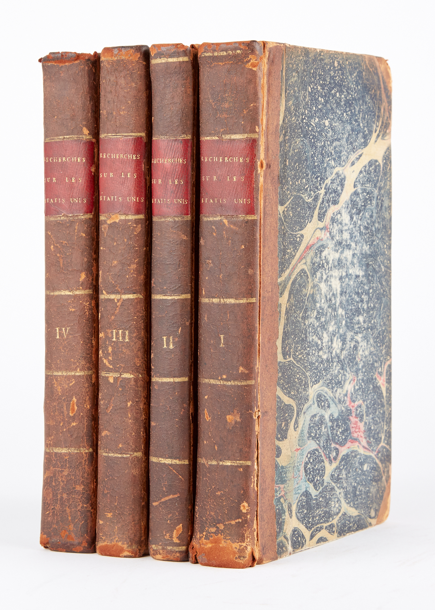
MAZZEI, PHILIP Recherches Historiques Et Politiques Sur Les États-Unis De lAmérique Septentrionale ... Par un citoyen de Virgi...
Estimate: $400 - $600
Sold for $409
(includes buyer's premium)
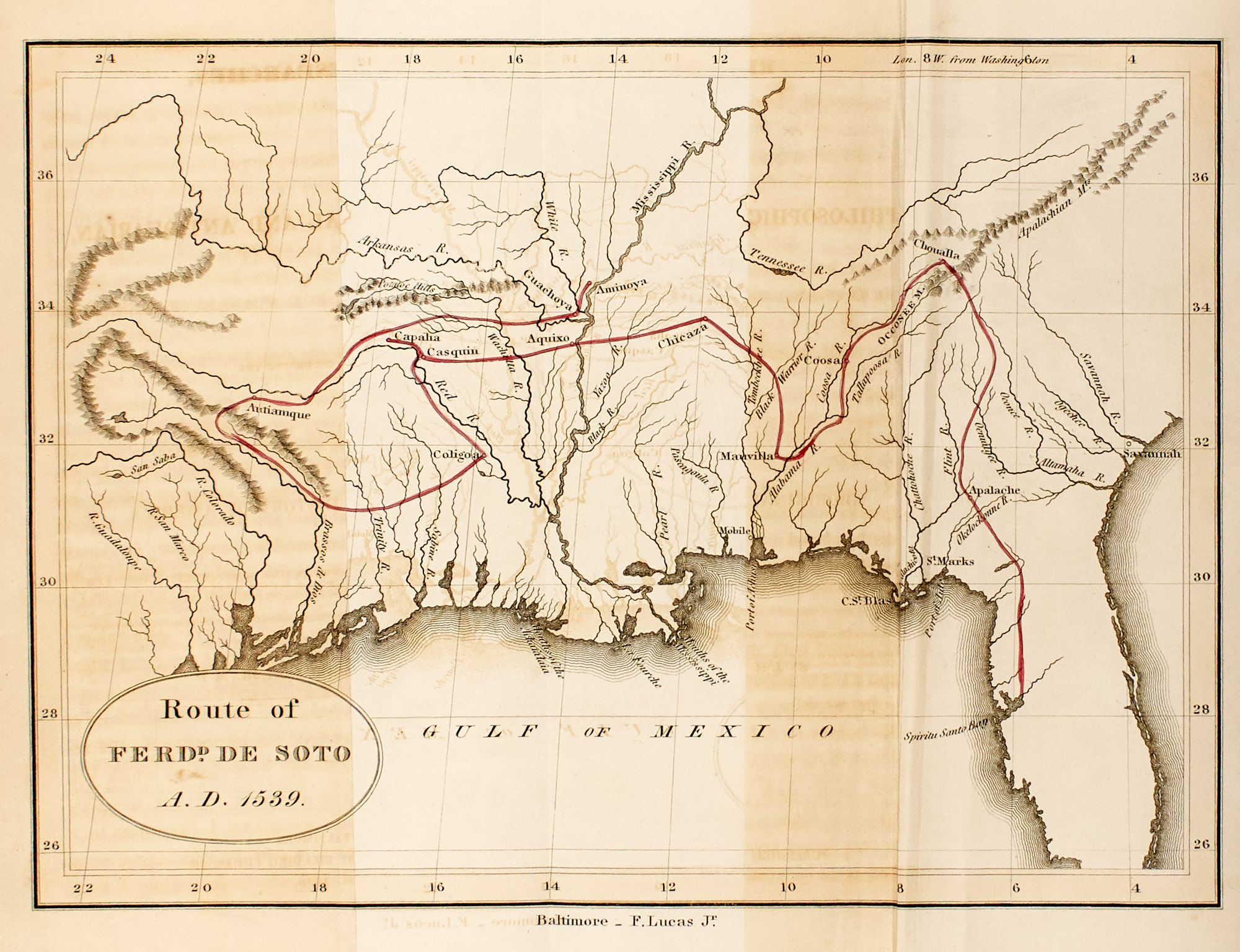
Lot 228
McCULLOH, J. H., Jr, M.D. Researches, Philosophical and Antiquarian concerning the aboriginal history of America. Baltimore:...
Estimate: $300 - $500
Sold for $283
(includes buyer's premium)
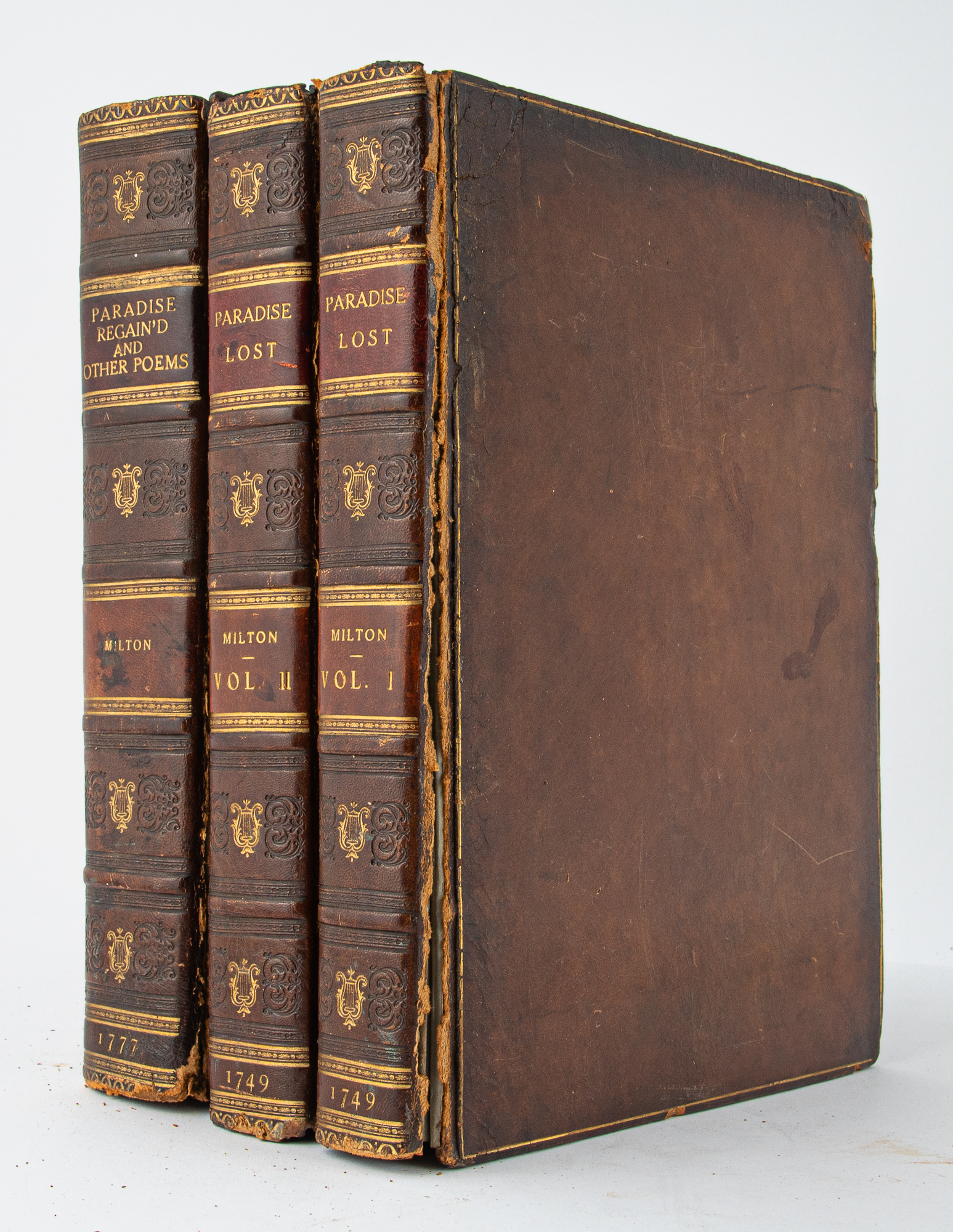
Lot 229
MILTON, JOHN Paradise Lost. A Poem in Twelve Books. A New Edition with notes by Thomas Newton. London: J. and R. Tonson and...
Estimate: $300 - $500
Sold for $1,260
(includes buyer's premium)
![Lot image - [MEXICO-PHOTOGRAPHY] BLOM, GERTRUDE DUBY. Chiapas--Maya.](/sites/default/files/images/lots/870/1557870.jpg)
Lot 230
[MEXICO-PHOTOGRAPHY] BLOM, GERTRUDE DUBY. Chiapas--Maya. Mexico: Na Bolom, 1982. Copy 14 of 50 portfolios. Publishers gree...
Estimate: $200 - $300
Sold for $7,560
(includes buyer's premium)
![Lot image - [MEXICAN ART] Mural Painting of the Mexican Revolution, 1921-1960.](/sites/default/files/images/lots/857/1557857.jpg)
Lot 231
[MEXICAN ART] Mural Painting of the Mexican Revolution, 1921-1960. Mexico: Fonda Editorial de las Plastica Mexicana, 1960. F...
Estimate: $100 - $200
Sold for $75
(includes buyer's premium)
![Lot image - [MEXICAN WAR/FLORIDA-BALLENTINE, GEORGE] Autobiography of an English Soldier in the United States Army. Comprising Observations and Adventures in the States and Mexico.](/sites/default/files/images/lots/785/1557785.jpg)
Lot 232
[MEXICAN WAR/FLORIDA-BALLENTINE, GEORGE] Autobiography of an English Soldier in the United States Army. Comprising Observations...
Estimate: $200 - $300
Sold for $535
(includes buyer's premium)
![Lot image - [MEXICAN WAR] SCOTT, WINFIELD, General. Letter outlining his criticisms against General Edmund Pendleton Gaines at the outset of the Mexican War.](/sites/default/files/images/lots/955/1570955.jpg)
Lot 233
[MEXICAN WAR] SCOTT, WINFIELD, General. Letter outlining his criticisms against General Edmund Pendleton Gaines at the outset o...
Estimate: $800 - $1,200
Sold for $1,386
(includes buyer's premium)
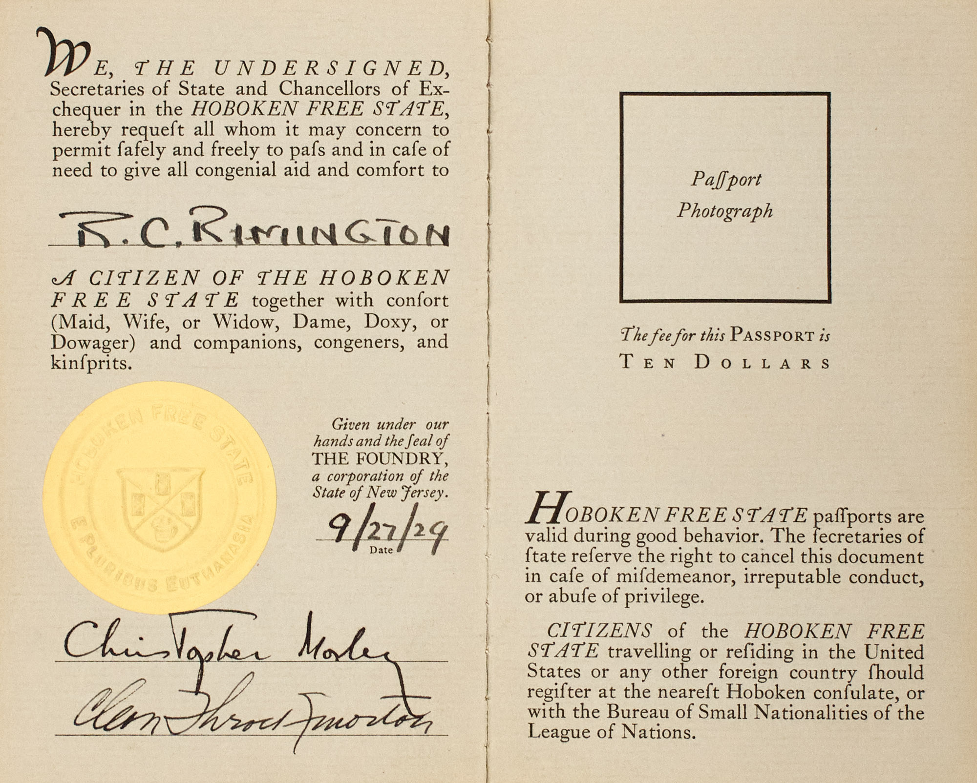
Lot 234
MORLEY, CHRISTOPHER Passport. Hoboken Free State. N.p.: s.n (1929). Copy 4, signed by Christopher Morley and Cleon Throckmorton, dat...
Estimate: $60 - $80
Sold for $283
(includes buyer's premium)
![Lot image - [MORMONS] SMITH, ETHAN. View of the Hebrews Exhibiting the Destruction of Jerusalem; The Certain Restoration on Judah and Israel; the Present State of Judah and Israel; and An Address of the Prophet Isaiah Relative to Their Restoration.](/sites/default/files/images/lots/779/1557779.jpg)
Lot 235
[MORMONS] SMITH, ETHAN. View of the Hebrews Exhibiting the Destruction of Jerusalem; The Certain Restoration on Judah and Israe...
Estimate: $300 - $500
Sold for $1,512
(includes buyer's premium)
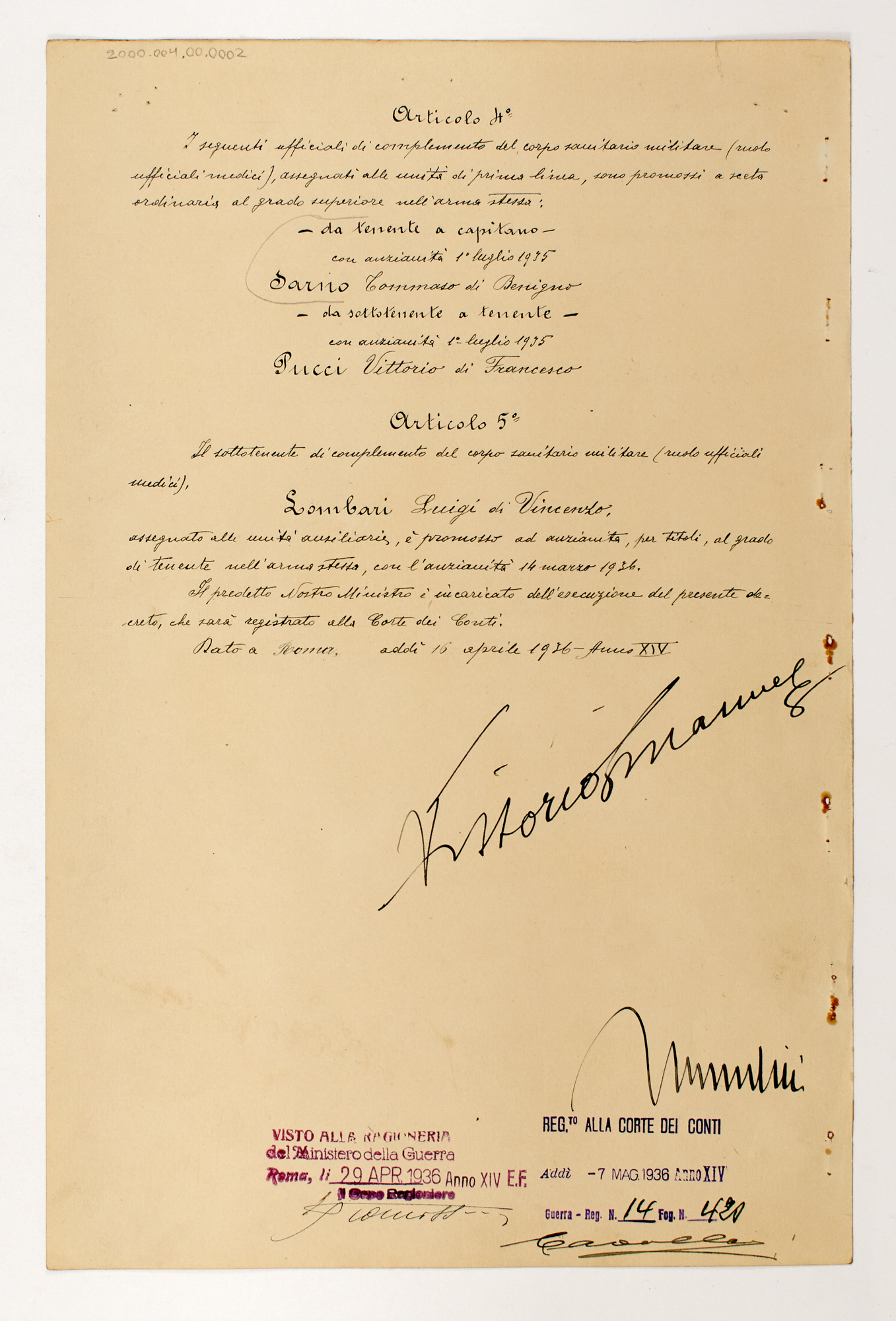
Lot 236
MUSSOLINI, BENITO and KING VICTOR EMMANUEL III Military document signed by the Italian King and Il Duce. A partially printed...
Estimate: $200 - $300
Sold for $598
(includes buyer's premium)
![Lot image - [NATIVE AMERICANS] Group of approximately twelve government issued reports relating to Native Americans in Florida and elsewhere.](/sites/default/files/images/lots/319/1571319.jpg)
Lot 237
[NATIVE AMERICANS] Group of approximately twelve government issued reports relating to Native Americans in Florida and elsewher...
Estimate: $200 - $300
Sold for $315
(includes buyer's premium)
![Lot image - [NATIVE AMERICANS-PAMPHLETS] Group of approximately forty 19th century pamphlet titles on Native American matters.](/sites/default/files/images/lots/701/1580701.jpg)
Lot 238
[NATIVE AMERICANS-PAMPHLETS] Group of approximately forty 19th century pamphlet titles on Native American matters. Includes...
Estimate: $200 - $300
Sold for $1,890
(includes buyer's premium)
![Lot image - [NATIVE AMERICAN-PRINTS] Six prints of Native American & American Revolutionary interest.](/sites/default/files/images/lots/554/1576554.jpg)
Lot 239
[NATIVE AMERICAN-PRINTS] Six prints of Native American & American Revolutionary interest. Six matted prints, visually fin...
Estimate: $100 - $200
Sold for $220
(includes buyer's premium)
![Lot image - [NATIVE AMERICANS] Reference collection of approximately one hundred twenty-five volumes on Native American subjects.](/sites/default/files/images/lots/767/1578767.jpg)
Lot 240
[NATIVE AMERICANS] Reference collection of approximately one hundred twenty-five volumes on Native American subjects. Variou...
Estimate: $150 - $250
Sold for $3,150
(includes buyer's premium)